Even though we're back home now I think I'll keep going and write up the rest of our New Zealand trip, it would be a shame to leave it uncompleted. So, taking up the story at Queenstown, I'll carry on.
From Queenstown we drove down to Te Anau on the edge of Fiordland, which was to be our base for a trip to Milford Sound. Everything that everyone says about Milford Sound is true. Out little boat sailed from dock at Milford Sound and out into the Tasman passing sheer cliffs diving straight into the sea, waterfalls and wildlife. We were lucky with the weather too, it was mainly overcast, but dry. The pictures will have to tell the story, I'm afraid.
So, (1) snow-capped mountains with waterfalls, (2) and (3) close-in to one of the waterfalls. The captain of the boat actually put the bowsprit under some of these falls.
New Zealand
Saturday, December 09, 2006
Friday, December 08, 2006
Written back home in Caversham, well after the events described.
We left Franz-Joseph on 9th November, and arrived at Queenstown later that afternoon where we booked in to our B&B, a Swiss-chalet high up on a hill overlooking the town and Lake Wakatipu. They'd had snow overnight before we arrived, even down in the town, but this had all gone by the time we got there. Our hosts were Joe, Swiss by birth (car registration 'SWISSIE') and Maria, who was born in The Netherlands, nice people.
Our journey from Franz-Joseph, on a cold, cloudless, clear day, took us over the Haast Pass and beside Lake Wanaka and Lake Hawea, the most terrific scenery. We stopped at the mirror lake of Lake Matheson to see the views of Mount Cook and Mount Tasman, at the Thunder Creek Falls, the Fantail Falls and the Blue Pools walk.
The pictures are (1) a view of Lake Hawea taken on the trip from Franz-Joseph to Queenstown, (2) the view over Queenstown and Lake Wakatipu, taken from the balcony of our B&B, and (3) an old lake steamer, the TSS Earnshaw, tied up alongside at Queenstown.
Saturday, November 25, 2006
Written back at Mission Bay, Auckland, still trying to catch up. I think I left off with us on our way to the Franz-Joseph glacier, so I'll pick up the threads from there.
We stopped at a decent little B&B at Franz-Joseph, after a very wet and windy drive. The next morning it had cleared and the sun was out, though still cold and we decided to do our walk up to the glacier. It's about a thirty-minute walk from the car park to the glacier, or as close as we were allowed to get to it, the whole thing is on the move all the time and huge lumps of ice and rock are constantly breaking off the leading edge. Snow falls up on the mountains and compresses under its own weight to form ice that moves downhill, behaving as a plastic solid and getting broken up and contorted in the process. At the leading edge melt-water pours out of an ice-cave, which can be seen in the picture. What the picture can't do, however, is give any idea of the scale of the glacier, it's immense. Just after we started the walk back to the car park it started to rain again, very heavily and we got soaked, but so what?
The pictures show Anne, on the path to the glacier and Anne at the Pancake Rocks.
Anne has just reminded me that on the way to Franz-Joseph we crossed two long, single-track bridges. Nothing strange about this; nothing except that the track is shared by railway trains, that is, you actually drive on the rails (which are close-boarded).
Sunday, November 19, 2006
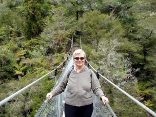
Nelson and onwards, written at Christchurch. At Nelson we stopped at a B&B called Sussex House, a pretty place by a river, nineteenth-century, white-boarding, verandahs and all very nice (see the first picture). Our main excursion from Nelson was to the Abel Tasman trail, we travelled by bus to Kaiteriteri, took a water taxi to Bark Bay and walked back along the coastal path to Torrent Bay where we were collected by the water taxi and taken back to Kaiteriteri. From here, back to Nelson, on the bus. A throughly enjoyable day. On the track from Bark Bay to Kaiteriteri there is what they call here a swing-bridge (it's actually a wire-rope bridge) that bounces when you walk on it (see the second picture, showing Anne on the bridge).
We left Nelson on 6th November and drove to Pancake Rocks, known to Maori as Punakaiki. Here we put up for the night in a cottage belonging to a motel. It was next to the beach and was, in fact, what New Zealanders call a bach (pronounced batch). More about baches later, but this was perfectly decent accommodation. The pancake rocks themselves were very impressive, strange water-worn things with layers. It was drizzling when we arrived and overnight the drizzle turned into a torrent. From Pancake Rocks we drove down the west coast to the village at the Franz Joseph glacier, in terrific rain all the way and without so much as a glimpse of the Southern Alps through the gloom.
All written well after the event again, I'm afraid and still trying to catch up. I'm writing this in a B&B at Christchurch on 19th November. Anyway, here goes, trying to pick up the story at Wellington.
Impressions of Wellington; much smaller than we'd expected, but nice, surrounded by steep hills, with some very pretty late Victorian and Edwardian houses, especially along the seafront, all timber with verandahs. We spent most of our stay here walking around the seafront and the museum. The weather was sunny in the main, but there was a wicked wind blowing from the south, a bit like the mistral, that throws dust in your eyes and makes your teeth ache. Had a not very good meal at a French restaurant which was also expensive, by NZ standards.
On the afternoon of the 3rd November we reported to the ferry terminal at Wellington for the crossing to the South Island, which took about three hours, less than a hour to leave the harbour behind, about another hour to cross the Cook Straights and about an hour steaming up the Queen Charlotte Sound (in the Tory Channel) to Picton. The scenery in the Queen Charlotte Sound is magnificent, with wooded hills dropping straight into the sea on boths sides. From Picton to our B&B in Nelson (by the quick route not the scenic one) arriving at about eight o'clock in the evening.
The pictures show (1) me, on the waterfront at Wellington, standing in front of an old steam floating crane and (2) the sun, detail from a modern Maori meeting-house built within the museum.
Sunday, November 12, 2006
BELATED SOUTH ISLAND BLOG. Sunday, 12th November. I'm writing this on the laptop in a motel in Te Anau, Fiordland, in the deep south of the South Island. Some kind person nearby has left a wireless Internet connection open that I've managed to latch onto, many thanks to my anonymous benefactor. Picking up the story from where I left off:
We left Auckland on 31st October and headed south for about an hour. We were then obliged to head north again to where we started, because one of us had left our travel plans behind in Mission Bay (no names, no pack-drill). After this local difficulty had been put right we drove to Taupo, where we checked into a motel on the lakeside. It was from here that we saw our first snow-capped mountains.
1st November. Left Taupo and took the Desert Road across to Waiouru and then on to to Paraparaumu, where we checked-in to a motel. On the way across the desert we stopped at the NZ army museum, looked around and had a bite to eat in the restaurant there. Outside the museum, an old cannon with a Russian double-headed eagle mark, but with no words of explanation. At Paraparaumu (called by the locals 'Paraparam') ate at a fish restaurant called 'The Mussel Boys', on the wall a display showing the secret life of the mussel.
2nd November. Departed Paraparaumu for Wellington and checked-in to our hotel. There were activities in Wellington that had brought a lot of visitors into the city for the week-end, including a veterans' rugby tournament. We had to struggle to book anywhere, but in the event the hotel was just fine, if a little, er, unprepossessing.
I'll post this now, and do some more when I get the chance. Only one picture, Anne with the old Russian cannon.
Sunday, October 29, 2006
Anne and I have just been down to the beach at Mission Bay. It's blowing an onshore gale and raining, but that wasn't stopping this chap. I think they call this kite-surfing and it looks enormous fun, but also looks to be hard work; they run across the wind at terrific speed.
Well, at least someone is finding the weather congenial.
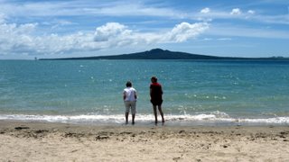
It's Sunday morning and time to write up the blog, now, where was I? Sheila and Rosemary arrived back at Mission Bay on Wednesday evening from their trip to the Bay of Island. They had a very good time and also had much better weather there than we did here. Thursday and Friday were taking-it-easy days, wandering around Devonport, Auckland and St Heliers. Yesterday, Sheila and Rosemary left for Melbourne, we dropped them off at the airport for the afternoon flight. Before they went, we went down to the beach and I took some pictures of them, saying goodbye to Rangitoto (see photo). The Auckland marathon came through Mission Bay this morning, but by the time we'd managed to drag ourselves out of bed the serious competitors were long gone, they didn't have too bad a day for it, windy, with showers later, but not cold.
While she was here, Rosemary was anxious to get a really good picture of a nice, regularly-shaped Norfolk Island pine, but I don't think she had much luck in doing this. Never mind, we are off for our grand tour of the South Island tomorrow, so I'll keep my eyes open for one to photograph there (I'll blog it, if I find one). I'm not sure how I'll manage keeping the blog up to date while we're away, it will depend on Internet availability at the places where we'll be stopping.
On Friday, in St Heliers, I bought a book, Fatal Frontiers, by Paul Moon. It's a good, sensible history of the decade 1830 to 1840 and covers the run-up to the signing of the Treaty at Waitangi; necessarily, much of it is concerned what happened around the Bay of Islands.
Wednesday, October 25, 2006
Today, we sighted the first cruise ship of summer, in the harbour at Auckland, it's called The World. I remember reading about this chunk of marine hardware a year of so ago, it claims to be not so much a cruise ship as a floating community where the so-inclined can buy apartments, live their lives and never set foot on dry land, unless they want to. Leastways, I suppose they're allowed to get off if they want to, but who knows?
There is an article on Wikipedia about The World, click here.
Hey-ho, it takes all sorts...
Looking back to an earlier blog, at the picture of the chap about to throw himself off of the Sky Tower, reminded me of an old joke of Max Miller's concerning the options available to someone standing on the edge of a precipice.
Subscribe to:
Posts (Atom)